When you live on an island in a hurricane-prone area, you keep a slightly more focused eye on what the weather is doing off the coast of Africa and in the Caribbean. Those are two of the spots where storms often start.
Recently, we were watching Tropical Storm - then Hurricane - Bertha. She looked mean (winds were 115 mph - category 3 - at their highest), and well organized. The satellite view yesterday looked like a textbook example picture of a hurricane. But she was far off, so we weren't too worried.
And then she simmered down (winds are now at 80 mph - category 1), and lost her classic-hurricane structure. It looks like she will blow away toward the north, staying well out to sea. Phew.
I completely missed whatever the "A" storm was this year (there must have been a named system, or we wouldn't be on Bertha now). But it's definitely a good thing when we don't hear about one.
We're in the clear for now. But I'll still "keep a weather eye on the horizon", just in case.
skip to main |
skip to sidebar
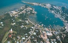
Musings, stories and photographs about my life on a small island off the coast of North Carolina.
About Me
- Ocrakate
- Ocracoke Island, NC, United States
- I am blessed and lucky to call Ocracoke Island, NC home. Ocracoke is beloved of residents and visitors, and I hope this blog will be a way for folks to keep in touch with what's going on here, both in general and in my life specifically. It's a fix for your Ocracoke jonesing!
Other blogs about Ocracoke
Links to some of my favorite Ocracoke things
Other Links
Blog Archive
-
▼
2008
(366)
-
▼
July
(31)
- Waving
- Thunder and ozone
- Lost something?
- Island nuts
- Jackpot!
- Song sirens
- Hometown tourist
- Game night
- Rainy mornings
- Bonfire
- Ocrafolk School 2008
- Who is it?
- Lots of water
- Cristobal might be coming
- Too busy
- A wonderful evening
- Puzzle people
- Island scenes
- Advice
- Pot luck party
- Fashion is not my friend
- Gray days
- BBQ Fund Raiser
- Bye, Bertha
- Sud-oh-no
- Spittin' seeds
- Misdelivery
- Happy Fourth!
- Multiple kinds of music
- Bushes and books
- Sunset stripes
-
▼
July
(31)
2 comments:
I believe that the "A" storm this year was "Arthur," a tropical storm that formed the end of May, before the official start of hurricane season.
Thanks for the info. on the A storm. The fact that it formed in late May, before the official start of hurricane season reminds me of a funny story. Last year, a meteorologist was being interviewed about a May storm, and the (obviously new/inexperienced) reporter asked "How is it possible that this is a hurricane, if it's before hurricane season?" (or something to that general effect). After a short pause, they meteorologist said, "Well, Mother Nature really isn't interested in the schedules we humans set" (or something to that general effect). I thought it was hilarious. :)
Post a Comment