
The curve of Back Rd, right near the Back Porch restaurant floods even with a standard thunderstorm, so it's no match for a tropical storm or nor'easter.

Highway 12 near the Youth Center, and storm clouds still hovering.

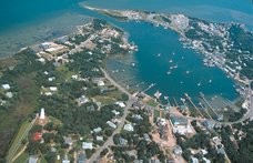
The Youth Center beach scene has a replica of the ocean to go along with it now!

It was not a good day for an concert at the outdoor stage near Books to be Red.

Silver Lake harbor headed for Silver Lake Drive.

Sunset Drive (or perhaps we should call it Sunset Creek?) right near my house.
Here's the second public advisory which was sent out this morning.
Public Advisory #2
Date: Thursday, November 12, 2009; 11:30 am
Event: Ida Nor’easter
Media Contact: Jamie Tunnell, jamietunnell@gmail.com
A coastal flood warning is in effect until 8:00 am Saturday, November 14. Residents and visitors should be alert for rising water and take appropriate action to protect life and property.
A strong low pressure system will move slowly along the coast today and produce strong northeast winds of 30 to 40 mph. The strong winds and building seas could result in overwash and coastal flooding. Rough surf conditions are expected along with a high threat of dangerous rip currents in ocean waters.
Motorists should be alert for significant water on roadways and localized flooding in low area. Drivers should proceed with extreme caution. Only travel when necessary and be aware of roadside ditches that may not be visible through the overwash. Turn around. Don’t drown.
Highway 12 is open south of the Oregon Inlet Bridge. However, passage may be reduced to one lane in portions of Highway 12 through the Pea Island National Wildlife Refuge to the Rodanthe area. Throughout the storm, road conditions could worsen especially around periods of high tide and travel should be planned accordingly. The next period of high tide is expected at approx 4:45 pm Thursday afternoon.
Hyde County Government Offices will be closed today, Thursday, November 12, 2009 due to severe weather including extreme tides and road flooding. The Government Center will re-open on Friday, November 13, 2009 at 10:00 a.m.
Hyde County Emergency Services continues to review the latest weather forecasts, is coordinating with the State and nearby counties, and advising citizens on possible actions to protect themselves and their property. Further updates will be issued as warranted.
Please make yourselves aware of the state ferry system’s schedule and road conditions before making travel plans during this time and after the storm has passed.
Stay tuned to www.noaa.gov and local news and radio stations for the latest updates.
Storm Basis Preparation Initial Checklist:
* Check First Aid Kits/ Fire Extinguishers
* Obtain medicine and prescriptions
* Check and fuel vehicles and generators
* Obtain cash
* Make pet arrangements
* Pick up loose items around the yard
* Protect vulnerable portions of property
* Obtain non-perishable food and water for 3+ days (5+ recommended for Ocracoke)
* Obtain baby need or personal need items
* Check battery powered electronics and generators
* Assemble valuables and documents that cannot be replaced easily
No comments:
Post a Comment