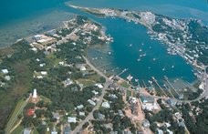
I took a picture yesterday morning of a storm out over the ocean, but I am going to have to upload it here later. My camera is in the car at the moment, and it's currently pouring down rain, so I'm not going out to get it! But I wanted to give everyone an update on the Nor'Easter that is visiting us at the moment, so here's the latest that I know.
Here's the public advisory that was sent out earlier today:
Public Advisory #1
Date: Wednesday, November 11, 2009; 2:30 pm
Event: Ida Nor’easter
Media Contact: Jamie Tunnell, jamietunnell@gmail.com
A hazardous weather outlook from the National Weather Service warns residents of the Outer Banks of a high threat of dangerous rip currents and extremely rough surf through Friday and a high wind warning in effect from 7 pm this evening to 7 pm Thursday afternoon.
Remnants of Ida, coupled with strong high pressure to the north, will produce strong winds, coastal flooding especially at times of high tide, and high surf through Friday. Storm total rainfall may reach 5-8 inches area-wide with the potential for localized fresh water flooding.
Along the Outer Banks, in addition to high breaking waves and overwash, the extratropical storm surge will be 2 to 3 feet. Significant flooding along coastal sections from Hatteras North is possible. By Friday astronomical tides will begin to build again, which will add to the coastal flooding impacts.
Motorists should be alert for significant water on roadways and localized flooding in low area. Be aware of potential flooding of Highway 12 North around the Rodanthe area.
Hyde County Emergency Services continues to review the latest weather forecasts, is coordinating with the State and nearby counties, and advising citizens on possible actions to protect themselves and their property. Further updates will be issued as warranted.
Please make yourselves aware of the state ferry system’s schedule and road conditions before making travel plans during this time and after the storm has passed.
Stay tuned to www.noaa.gov and local news and radio stations for the latest updates.
Storm Basis Preparation Initial Checklist:
* Check First Aid Kits/ Fire Extinguishers
* Obtain medicine and prescriptions
* Check and fuel vehicles and generators
* Obtain cash
* Make pet arrangements
* Pick up loose items around the yard
* Protect vulnerable portions of property
* Obtain non-perishable food and water for 3+ days (5+ recommended for Ocracoke)
* Obtain baby need or personal need items
* Check battery powered electronics and generators
* Assemble valuables and documents that cannot be replaced easily
##
And here's a link to a radar view of the storm.
And here's a link to an article about it.
Subscribe to:
Post Comments (Atom)

No comments:
Post a Comment