Looking the other way down Sunset/Firehouse:

I think this was probably close to the highest point...water all the way across Sunset and into yards on both sides.

The end of Sunset, where it meets Trent.

Looking down Trent toward Middle/Hickman.

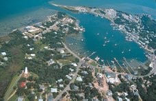
The rest of the pictures are from the Oyster Creek area. Thanks go to my friend Brian for the photo tour in his truck.
Hard to tell where the canals end and the land begins.

The orange cone to mark the low spot in the road made me laugh.


Water coming up over the dock at Brian's house.

There's usually a LOT more head clearance if you take a boat or kayak under this bridge.

Here's the latest update from Dare County.
For Immediate Release:
Saturday, November 14, 2009
10:15am Contact: Dorothy Toolan
252-473-8328
Coastal Storm Update
NC Highway 12 on Hatteras Island continues to be closed south of the Oregon Inlet Bridge to Rodanthe. North Carolina DOT is working to remove sand and water from the road, but it is not expected to be open today.
For those wanting to depart Hatteras Island to reach the mainland, a special ferry is tentatively planned for 12:00 pm today. If conditions permit, a ferry is scheduled to leave Hatteras Village at 12:00 pm today for Ocracoke Island. Travelers will then connect with another ferry in Ocracoke for passage to the mainland via Swan Quarter. The regular fee will apply to the mainland portion of the trip. Reservations are required and can be made by calling
252-928-5311.
Along the Outer Banks, continue to expect water on roads in areas prone to flooding. Drivers should proceed with caution.
In Kill Devil Hills and Kitty Hawk, NC Highway 12, known as the Beach Road, has portions closed.
NC Highway 12 is open from Southern Shores to Corolla.
In Nags Head, all roads are open. Some side streets may have debris.
Extremely dangerous surf conditions and rip currents exist through Saturday.
Dare County Emergency Management will continue to closely monitor the situation and issue advisories as needed. Updates are available at www.darenc.com, Cable Channel 20 and NOAA Weather Radio.
2 comments:
Thanks for all the pics Kati! I've not seen my house yet, but, based on your pics, I'm guessing I have water in the yard. I'm hoping that's all. Somebody is supposed to go by there sometime today. Glad to see the water is beginning to recede. I've been watching the Harbor Inn webcam. Seeing where the water is and was on the docks gives me a good sense of which way the water is headed.
Hi Tom - sorry I didn't get a picture of your house...I didn't even venture down Back in that direction since it looked so deep. Friends I know who live near there had water in the yard but nothing in the house, so I bet yours was the same. I have not heard of any homes getting water in them. Whew!
Post a Comment