Public Advisory
Date: Thursday, September 30, 2010, 10 AM
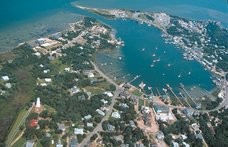
Event: Tropical Storm/Depression Nicole
Media Contact: Jane Hodges, jhodges@hydecountync.gov
The National Weather Service continues to monitor eastern North Carolina. An additional
3-6" of heavy rain is expected throughout the day across Hyde County. There is a tornado watch issued until 1 PM and a coastal flood warning until 1:45 PM today.
There are reported secondary road flooding in Hyde County. Please use extreme caution
in these areas. Do not drive through areas with standing water. Dare County reports rain water accumulation along NC 12 on Hatteras Island especially about three miles south of bridge.
The main threat of oceanside flooding will be south of Cape Hatteras around the times of
high tide around noon today.
Winds are recorded at sustained 25-35 mph with gusts up to 50 mph. Secure loose items
in your yard and businesses to prevent further damage.
All Hyde County Schools are closed today.
All Hyde County Government offices are open today.
Please make yourselves aware of the state ferry system's schedule and road conditions
before making travel plans during this time and after the storm has passed.
As seen in the past, hurricanes and tropical storms are unpredictable and can change with
little notice. Residents and visitors need to remain vigilant and not let your guard down.
Hyde County Emergency Services continues to review the latest weather forecasts, is
coordinating with the State and nearby counties, and advising citizens on possible actions to protect themselves and their property. Further updates will be issued as warranted.
Subscribe to:
Post Comments (Atom)
No comments:
Post a Comment